Fort Ward Park
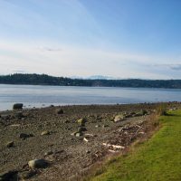
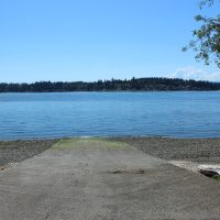
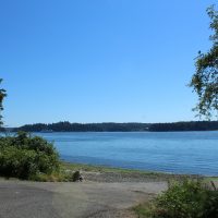
Fort Ward Park is a 137-acre marine park with 4,300 feet of saltwater shoreline on Rich Passage. Many of the structures in the park reflect the historic military significance of the area, but the park is well developed for day use. There is an underwater park for scuba divers, a two-lane boat ramp and a long, rocky beach along Rich Passage. This park is on the Cascadia Marine Trail, campsites are on a first come first serve basis for paddle craft users only. There are limited services available and we ask that patrons practice “leave no trace” principals.
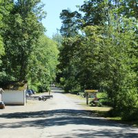
Fort Ward Park’s upper parking lot, is located on the east side of the park, accessible from Fort Ward Hill Road NE. From NE Country Club Road, turn right onto Fort Ward Hill Road NE and follow Fort Ward Hill Road NE for about 1 1/2 mile to the park’s entrance road, which is marked by a Fort Ward Park sign. Drive down the paved entrance road to the upper parking lot.
Park hours/updates:
Open year round, 8 a.m. to dusk.
Picnic and Day-use Facilities
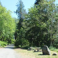
There are 12 unsheltered picnic tables with grills, available first come, first served. The upper picnic area is accessible by automobile. The lower picnic area (along Rich Passage) is accessible by foot only.
Fees
Boat launch is available free of charge.
History
After World War II, the U.S. Navy used a radio tower (once located adjacent to the park and east of the upper picnic area) to send messages to Navy Command in Seattle at Pier 91.
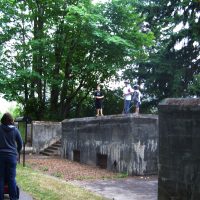
In 1903, Fort Ward was officially commissioned as a seacoast fort with the primary objective of protecting the Bremerton Naval Shipyard. Two gun batteries are located in the park. During World War II, the navy used the fort as a radio station and training school for communication personnel and installed a submarine net across Rich Passage. In 1958, the navy decommissioned the fort, and State Parks purchased Fort Ward in 1960. Ownership of the Park was transferred to the Bainbridge Island Metro Park & Recreation District June 4, 2011.